The German standard for systematic quality assessment of cycling infrastructure against ERA 2010 target values.
ERA 2010 (Empfehlungen fuer Radverkehrsanlagen) is the primary German technical regulation defining the target state for planning, design, and operation of cycling infrastructure. Published by the FGSV (Forschungsgesellschaft fuer Strassen- und Verkehrswesen), it specifies minimum widths, safety strips, surface requirements, and separation distances for every facility type from structural cycle paths to bicycle streets. The HEBRA methodology (Hinweise zur einheitlichen Bewertung von Radverkehrsanlagen) provides a deficiency-oriented assessment framework that converts measured deviations from ERA target values into Loss Points (Verlustpunkte), which are summed to determine a Quality Level (Qualitaetsstufe) from A to F. This evaluation drives prioritization of cycling infrastructure improvements across German municipalities and regions.
What is ERA 2010?
ERA 2010 (Empfehlungen fuer Radverkehrsanlagen) combined with the HEBRA evaluation methodology is the German standard for assessing cycling infrastructure quality. Inspectors measure width compliance, surface condition, and safety parameters against ERA target values to produce a Quality Level from A (High) to F (Unsuitable).
- Full Name
- Empfehlungen fuer Radverkehrsanlagen (ERA 2010) with HEBRA Assessment Methodology
- Issuing Body
- FGSV (Forschungsgesellschaft fuer Strassen- und Verkehrswesen)
- Current Revision
- ERA 2010 / HEBRA 2021
Cycling Facility Types and Width Compliance (Fuehrungsformen & Breiten)
ERA 2010 defines seven distinct cycling facility types, each with specific target widths and safety strip requirements that form the baseline for HEBRA quality assessment.
The ERA 2010 standard classifies cycling infrastructure into seven facility types (Fuehrungsformen), each with different design parameters and minimum width requirements. The classification determines the target width (Soll-Breite) that inspectors compare against the measured usable width (Nutzbare Breite) during field assessment. A Radweg (structural cycle path) is a physically separated facility with its own surface, requiring a target width of 2.00 meters for one-directional travel or 2.50 meters for bidirectional use. A Radfahrstreifen (cycle lane) is a marked lane on the road surface dedicated to cyclists, typically requiring 1.85 meters. A Schutzstreifen (advisory lane) is marked with dashed lines and may be used by motor vehicles when necessary, requiring at least 1.50 meters including the marking.
Shared paths (Gemeinsamer Geh- und Radweg) combine pedestrian and cycling traffic on a single surface and require wider dimensions of 2.50 meters minimum due to the mixed-use conflict potential. Separated paths (Getrennter Geh- und Radweg) provide distinct surfaces for pedestrians and cyclists side by side, requiring at least 2.00 meters for the cycling portion. A Fahrradstrasse (bicycle street) gives priority to cycling traffic while allowing limited motor vehicle access, requiring the full carriageway width. Mixed traffic (Mischverkehr) applies where cyclists share the road with motor vehicles without dedicated infrastructure, assessed based on traffic volume and speed limit rather than width compliance.
| Facility Type | German Term | Target Width (m) | Key Characteristic |
|---|---|---|---|
| Structural Cycle Path | Radweg | 2.00 (one-way) / 2.50 (two-way) | Physically separated, own surface |
| Cycle Lane | Radfahrstreifen | 1.85 | Marked lane, dedicated to cyclists |
| Advisory Lane | Schutzstreifen | 1.50 | Dashed marking, shared when needed |
| Shared Path | Gemeinsamer Geh- und Radweg | 2.50 | Combined pedestrian and cycling |
| Separated Path | Getrennter Geh- und Radweg | 2.00 (cycling portion) | Side-by-side pedestrian and cycling |
| Bicycle Street | Fahrradstrasse | Full carriageway | Cycling priority, limited motor access |
| Mixed Traffic | Mischverkehr | N/A | Shared road, no dedicated facility |
Target widths represent ERA 2010 standard dimensions (Regelmasse). Higher cycling volumes (>1,000 cyclists/day) require wider facilities. Usable width excludes curbs and markings.
In the digital form, the inspector selects the Facility Type and the system determines the corresponding ERA target width. The difference between the target and actual measured width is the primary input for HEBRA Loss Point calculation. Width deficiencies account for the largest share of loss points in most cycling infrastructure assessments, making accurate measurement critical. The Safety Strip to Road (Sicherheitstrennstreifen zur Fahrbahn) and Safety Strip to Parking (Sicherheitstrennstreifen zu Parkstaenden) fields capture the separation distances that protect cyclists from motorized traffic and door-opening hazards. ERA 2010 specifies minimum safety strips of 0.50 to 0.75 meters depending on the adjacent traffic speed and parking configuration.
For comparable cycling infrastructure assessment methodologies, see the LTN 1/20 CLOS standard.
Surface Condition Grading (Zustandsnote nach ZEB)
The ERA 2010 assessment includes a five-level surface condition scale that evaluates the riding quality and structural integrity of the cycling surface.
ERA 2010 surface condition assessment uses a five-point grading scale derived from the German road inspection system (ZEB - Zustandserfassung und -bewertung), adapted for cycling infrastructure surfaces. Grade 1 (Neuwertig / Very Good) represents new or as-new condition with a smooth, defect-free surface providing optimal riding comfort. At this level, the surface material is intact with no visible cracks, settlements, or wear patterns. Grade 2 (Gut / Good) indicates minor wear that does not affect riding comfort or safety. Slight surface abrasion or minimal joint widening in paver surfaces fall into this category. The surface remains fully functional and requires only routine monitoring.
Grade 3 (Befriedigend / Satisfactory) marks the transition point where surface defects begin to affect riding comfort. Patched areas, slight unevenness from root growth under 2 centimeters, and moderate joint deterioration in paver surfaces are typical indicators. At this level, cyclists notice the surface but can ride safely at normal speed. Grade 4 (Ausreichend / Sufficient) represents condition where riding comfort is noticeably impaired. Cracks, root heaves between 2 and 5 centimeters, loose pavers, and significant surface roughness reduce cycling speed and may cause discomfort. This grade triggers planning for surface rehabilitation. Grade 5 (Mangelhaft / Poor) indicates a safety hazard. Potholes, root heaves exceeding 5 centimeters, large areas of loose material, and severely uneven surfaces make the facility dangerous or unusable. Immediate action is required at this level.
| Grade | German Term | English | Description |
|---|---|---|---|
| 1 | Neuwertig | Very Good | New condition, smooth surface, no defects |
| 2 | Gut | Good | Minor wear, no impact on riding comfort |
| 3 | Befriedigend | Satisfactory | Patched areas, slight unevenness, acceptable comfort |
| 4 | Ausreichend | Sufficient | Cracks, root heaves <5 cm, comfort noticeably impaired |
| 5 | Mangelhaft | Poor | Potholes, root heaves >5 cm, safety hazard |
Surface condition is assessed visually during on-site inspection. The grade directly influences Loss Point calculation in the HEBRA methodology.
The Evenness (Ebenheit) field supplements the condition grade with a three-level assessment of surface roughness: Smooth (Glatt), Rough (Rau), and Very Rough (Sehr rau). This subjective measure captures the riding vibration experience that may not be fully reflected in the visual condition grade alone. For example, a cobblestone surface (Natursteinpflaster) may receive a condition grade of 2 for being structurally intact while scoring Very Rough for evenness due to inherent material properties. The Drainage Defect toggle records whether standing water or poor drainage affects the segment, a critical safety factor during wet conditions.
Try this ERA 2010 form in Geocadra
We have a pre-built ERA 2010 inspection template ready to go. Sign up and start your first condition assessment today.
Free 14-day trial. No credit card required.
Verlustpunkte: How Loss Points Determine the Quality Level
The HEBRA Loss Point system is the methodological core of ERA 2010 quality assessment, converting measured deviations from target values into a six-level Quality Level classification.
What distinguishes the ERA 2010 / HEBRA assessment from subjective infrastructure ratings is its deficiency-oriented scoring through Loss Points (Verlustpunkte). Rather than asking inspectors to assign a general quality impression, the methodology requires precise measurements of key parameters that are compared against ERA 2010 target values. Each deviation from the target generates loss points proportional to its magnitude and weighted by its impact on cycling safety and comfort. The width deficiency is the most heavily weighted parameter. If a structural cycle path (Radweg) measures 1.60 meters against a target width of 2.00 meters, the 0.40-meter shortfall generates loss points according to a defined transfer function. Small deficiencies near the target produce few loss points, while severe narrowing produces disproportionately more, reflecting the exponential increase in conflict risk as usable space decreases.
Safety strip deficiencies are evaluated separately for the road side and the parking side. A missing or inadequate safety strip to parallel parking (Sicherheitstrennstreifen zu Parkstaenden) is particularly critical because it exposes cyclists to door-opening collisions, one of the most common cycling accident types in urban areas. ERA 2010 requires a minimum of 0.50 meters, with 0.75 meters recommended where parking turnover is high. Surface condition grades above 3 generate increasing loss points, with Grade 5 producing the maximum penalty. The evenness assessment, drainage defects, guidance system quality, and visual connection at junctions all contribute additional loss points. Each parameter has a defined maximum loss point value, ensuring that no single deficiency can dominate the overall score beyond its actual safety impact.
| Level | Symbol | Quality | Description |
|---|---|---|---|
| A | ++ | High Quality | Exceeds ERA standards, minimal or no loss points |
| B | + | Good Quality | Meets ERA standards fully |
| C | o | Basic Quality | Minor deviations from ERA, acceptable |
| D | - | Deficient | Significant deviations, improvement planning required |
| E | -- | Poor | Severe safety or comfort deficits, priority action |
| F | --- | Unsuitable | Dangerous or unusable, immediate action required |
Quality Levels are determined by the total accumulated Loss Points (Verlustpunkte). The thresholds between levels are defined in the HEBRA methodology (2021).
The accumulated loss points for a segment are summed and mapped to one of six Quality Levels (Qualitaetsstufen A through F). Level A (High Quality, ++) means the facility exceeds ERA standards with zero or minimal loss points. Level B (Good Quality, +) indicates full ERA compliance. Level C (Basic Quality, o) shows minor deviations that do not significantly affect safety or comfort. Level D (Deficient, -) signals significant shortfalls requiring planning of improvements. Level E (Poor, --) represents severe safety or comfort deficits demanding priority intervention. Level F (Unsuitable, ---) means the facility is dangerous or unusable and requires immediate closure or reconstruction. German municipalities use the Quality Level distribution across their cycling network to prioritize capital investment and track improvements over time.
For a comparable pavement quality assessment used on German road networks, see the FGSV E EMI pavement standard.
Traffic Safety and Spot Defect Recording
Beyond segment-level measurements, ERA 2010 assessment captures specific safety parameters and localized defects that create point hazards along the cycling route.
The traffic safety assessment evaluates three critical parameters that affect cyclist safety independently of the geometric and surface measurements. The Guidance System (Wegweisung) field records whether cycling wayfinding signage is present and functioning. Options range from Present and Good (Vorhanden und Maengelfrei) through Present and Defective (Vorhanden und Mangelhaft) to Missing (Fehlt). Missing or defective guidance particularly affects network function for unfamiliar cyclists, contributing to route discontinuity that is a primary barrier to cycling uptake in German cities. The Visual Connection (Sichtbeziehung) field assesses whether adequate sight lines exist at driveways, side streets, and junctions along the segment. Restricted visibility is a major accident risk factor, especially where cycle paths run behind parked cars or vegetation.
The Obstacles field uses a multi-select input to record physical objects that narrow the effective cycling width. Bollards (Poller), chicane gates (Umlaufschranken), bins (Muelltionnen), and vegetation (Bewuchs) are common obstructions. Each obstacle type represents a different hazard profile. Bollards and chicane gates are intentionally placed but often create dangerous pinch points for cargo bikes and trailers. Vegetation encroachment gradually reduces the usable width over the maintenance cycle and is the most common reversible obstacle type.
Spot Defects (Einzelstellen) are recorded as repeatable entries, allowing inspectors to log multiple localized hazards along a single segment. Each spot defect captures the Defect Type from four categories: Pinch Point (Engstelle) for locations where the width drops below the segment average, Root Damage for tree root uplift affecting the surface, Pothole for point depressions, and Other for unlisted hazards. The Measured Value field records the specific dimension of the defect, such as the restricted width at a pinch point in meters or the depth of a pothole. Photo evidence can be attached to each spot defect for documentation and later verification during improvement planning.
For tree-related infrastructure damage assessment, see the FLL Baumkontrolle standard.
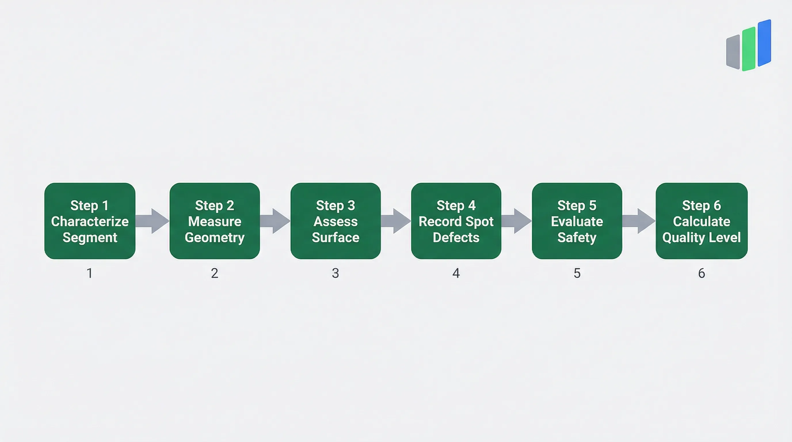
How an ERA 2010 / HEBRA Field Inspection Works
The ERA 2010 assessment follows a structured segment-based workflow from characterization through measurement to quality classification.
An ERA 2010 / HEBRA field inspection begins with segment characterization, where the inspector defines the route section to be assessed. The Segment ID uniquely identifies each link in the cycling network database. The Area Type (Ortslage) distinguishes between urban (Innerorts) and rural (Ausserorts) segments, which is critical because ERA width requirements and safety standards differ significantly between these contexts. Urban segments face higher conflict potential from driveways, pedestrians, and parking, while rural segments prioritize higher cycling speeds and longer sight distances.
The inspector records the Facility Type to establish the ERA target width, then measures the actual Usable Width excluding curbs and markings. The Speed Limit and Traffic Load (DTV MIV) of adjacent motorized traffic determine the stress level for mixed-traffic and advisory-lane assessments. A 30 km/h zone with fewer than 2,000 vehicles per day may be acceptable for mixed traffic, while a 50 km/h road with over 10,000 vehicles per day demands separated infrastructure. The surface assessment follows with material identification, condition grading, evenness evaluation, and drainage check.
After the segment-level assessment, the inspector walks or rides the segment to identify and record spot defects. Each pinch point, root damage, pothole, or other localized hazard is documented with type, measurement, description, and photo. Finally, the safety parameters are assessed: guidance system condition, visual connections, and obstacle presence. The digital form calculates Loss Points from all recorded parameters, applying the HEBRA weighting factors, and produces the Quality Level classification. The complete assessment for a typical 500-meter cycling segment takes 20 to 40 minutes depending on defect density and complexity.
The ERA 2010 standard is published by the FGSV (Forschungsgesellschaft fuer Strassen- und Verkehrswesen). Research on the HEBRA methodology has been published by the Technical University of Munich (TUM).
Frequently Asked Questions
What is ERA 2010?
ERA 2010 (Empfehlungen fuer Radverkehrsanlagen) is the German technical regulation defining target design parameters for cycling infrastructure. Combined with the HEBRA evaluation methodology, it provides a standardized framework for assessing cycling facility quality by measuring deviations from target widths, surface conditions, and safety parameters.
What are Loss Points (Verlustpunkte) in HEBRA?
Loss Points are the scoring mechanism in the HEBRA methodology. Each measured deviation from ERA 2010 target values generates loss points proportional to the deficiency magnitude. Points are weighted by safety impact and summed to determine the overall Quality Level from A (High) to F (Unsuitable).
What is the difference between ERA 2010 and LTN 1/20?
ERA 2010 is the German standard for cycling infrastructure design and assessment, while LTN 1/20 (Cycle Infrastructure Design) is the UK equivalent. Both define minimum widths and safety parameters, but ERA uses the HEBRA Loss Point system for quantitative quality grading, while LTN 1/20 uses the CLOS scoring framework.
How many Quality Levels does HEBRA define?
HEBRA defines six Quality Levels: A (High Quality, exceeds ERA), B (Good, meets ERA), C (Basic, minor deviations), D (Deficient, significant shortfalls), E (Poor, severe deficits), and F (Unsuitable, dangerous or unusable). The level is determined by accumulated Loss Points from all assessed parameters.
What facility types does ERA 2010 cover?
ERA 2010 defines seven cycling facility types: Radweg (structural cycle path), Radfahrstreifen (cycle lane), Schutzstreifen (advisory lane), Gemeinsamer Geh- und Radweg (shared path), Getrennter Geh- und Radweg (separated path), Fahrradstrasse (bicycle street), and Mischverkehr (mixed traffic).
Is ERA 2010 legally binding in Germany?
ERA 2010 is a technical recommendation (Empfehlung) rather than a binding regulation. However, it is widely recognized as the accepted state of the art (anerkannte Regeln der Technik) and is referenced in court decisions, funding criteria, and municipal planning directives, making compliance effectively mandatory for publicly funded projects.
How often should an ERA 2010 / HEBRA assessment be performed?
HEBRA assessments are typically conducted every 3 to 5 years to track quality changes and reprioritize improvements. Municipalities often align cycling infrastructure assessments with their road condition survey cycles. More frequent assessment may follow major construction or improvement projects.
Digitize your ERA 2010 inspections
Replace paper forms and spreadsheets with structured digital inspections — built for standards like ERA 2010.
Free 14-day trial. No credit card required.