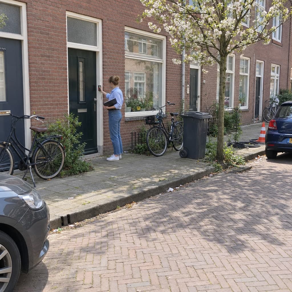
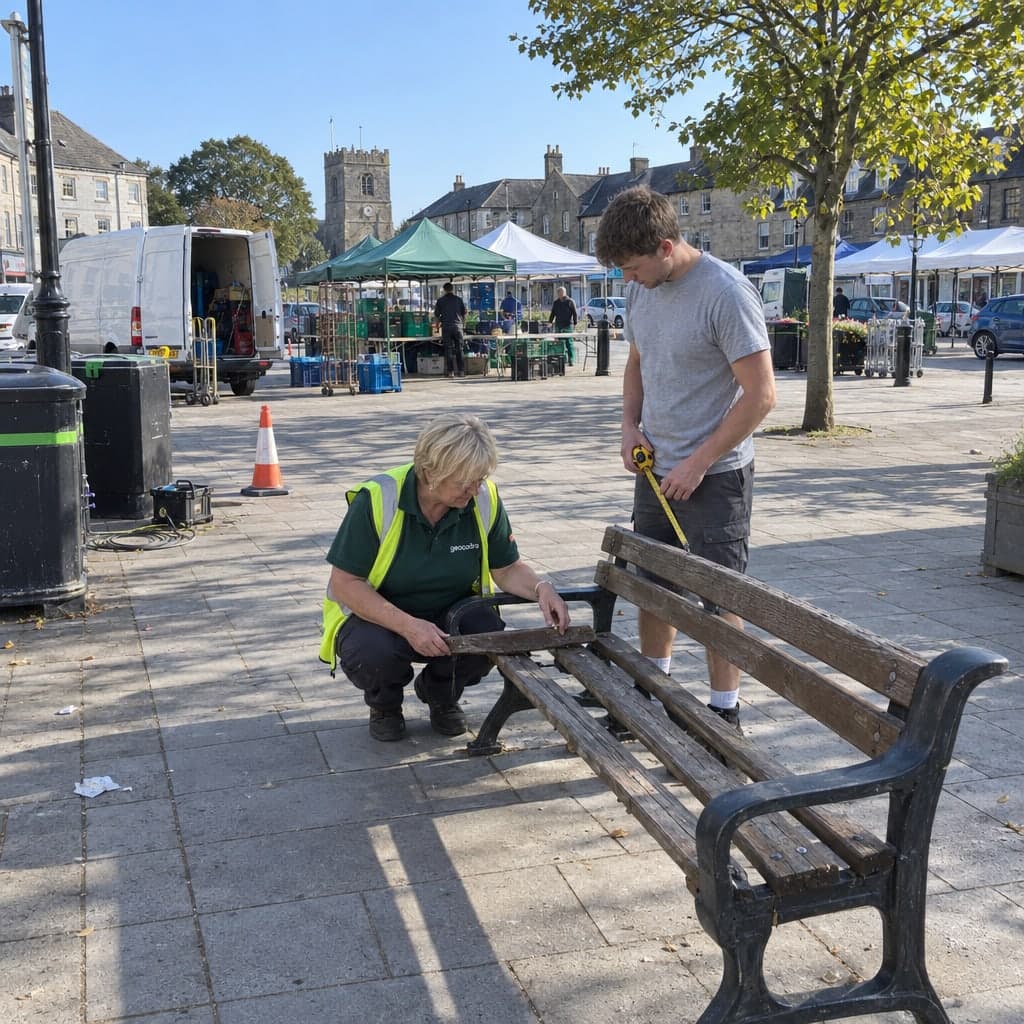
Playground checks, headstone tests and green-space acceptances on a map, with every round appended to the site
Playground, cemetery, green-space and street checks kept as one history per site, from the weekly walk-round to the annual expert inspection.A playground is checked every week by the depot, every quarter in more depth, and once a year by a certified inspector. A cemetery tests every headstone once a year. A green-space contract is accepted section by section. Each of these is a round over the same sites, and each produces evidence a court or an auditor may ask for years later. Geocadra keeps the sites as one map layer, runs every round as a project on that layer and appends each check to the site it belongs to.
Worked example
A town's play equipment, inspected item by item every year
The screenshots on this page are not mock-ups. They come from the Geocadra demo workspace, where 70 pieces of play equipment in seven public play areas of Leighton Buzzard, England, were taken from OpenStreetMap and given an annual main inspection in 2025 and in 2026 with one inspection form. Positions and equipment types are the real OpenStreetMap data; the council, site names, manufacturers, defects, risk ratings, photos and inspectors are demo data.
Dataset
Play equipment in seven play areas, Leighton Buzzard
- Publisher
- OpenStreetMap contributors
- Licence
- Open Database Licence (ODbL) 1.0
- Coordinate system
- EPSG:4326 (WGS 84)
- Extract
- 70 items of equipment, 19 KB GeoJSON
 01
01Import the equipment
The file is in WGS 84. The importer reads it, places the 70 items of equipment on the map and keeps the equipment ID, play area, equipment type and description as attributes. Save as one layer.
 02
02Set up the inspection form
One form per item of equipment: the item, the inspection type, the impact-absorbing surfacing with its loose-fill depth, then one entry per defect with component, defect type, risk rating, action required, action-by date and photos, and the overall condition, highest risk and usability. Here it follows the European playground standard EN 1176.
 03
03Run the round on the play areas
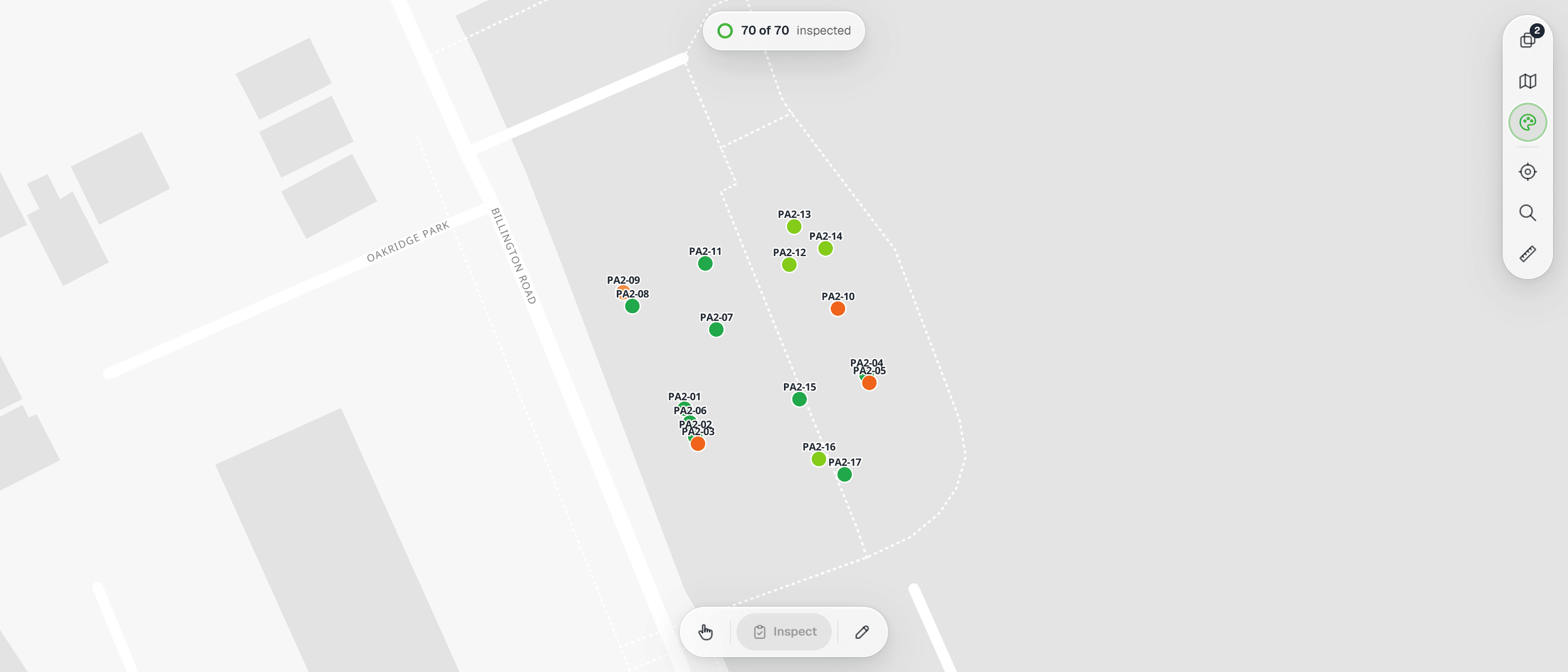
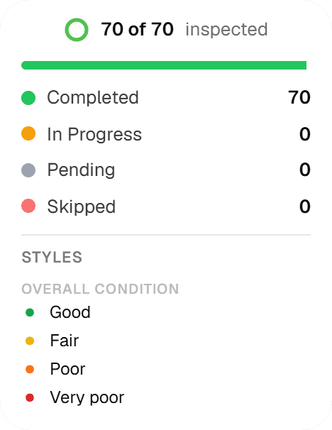
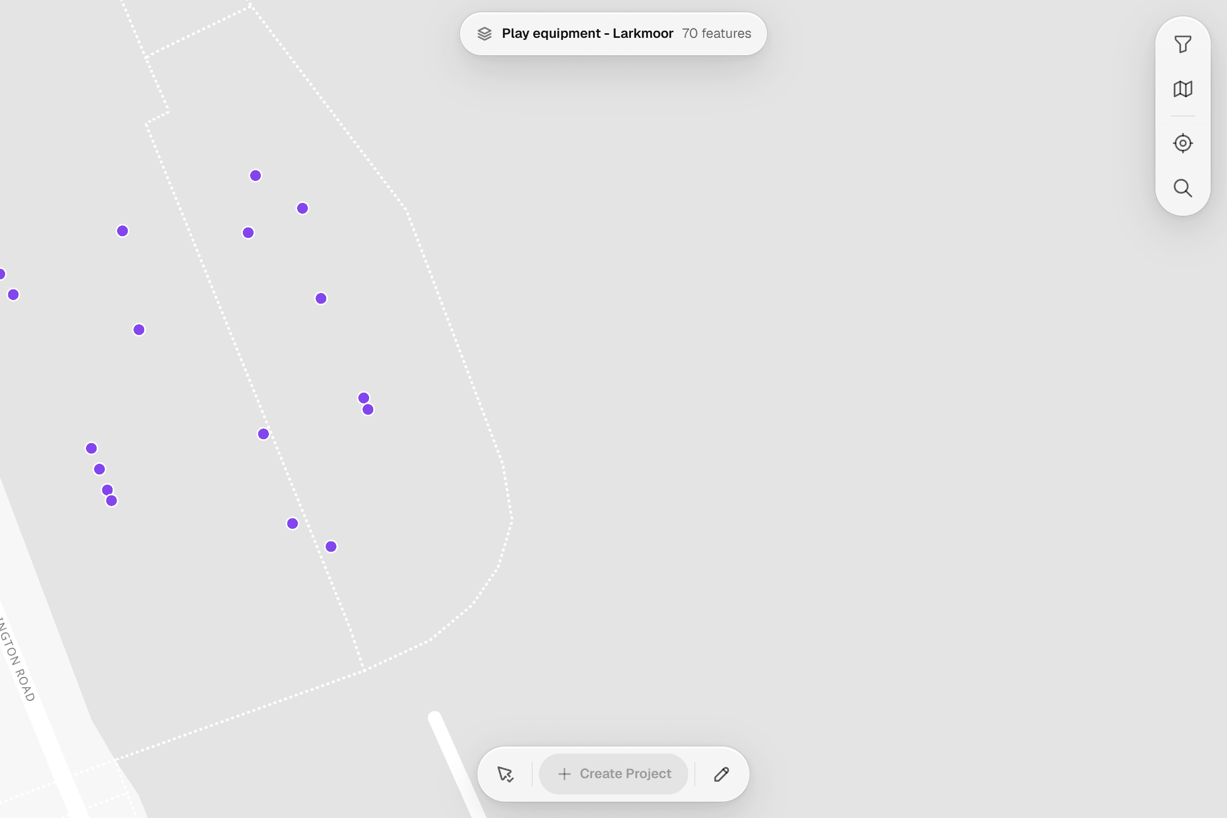
The 2026 annual main inspection covers all 70 items and is done in the screenshot: the map colours each item at one play area by its overall condition, and the status panel counts every item in the round.
 04
04Inspect at the equipment
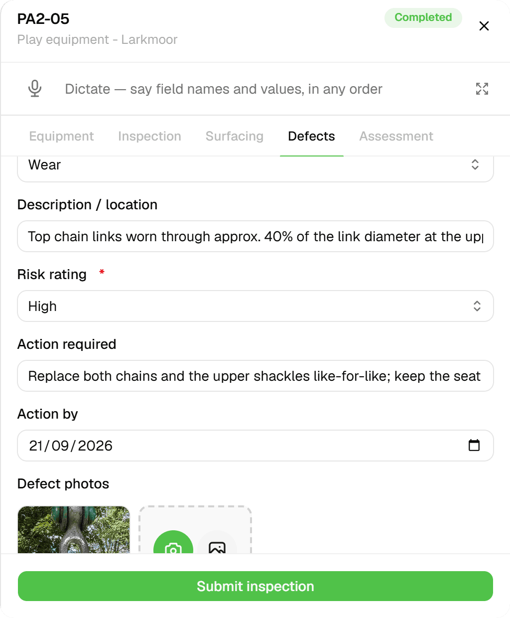
Tap the item, open the form: equipment, inspection and surfacing, then one defect after another with component, defect type, description, risk rating, the action and its date, and photos, then the assessment.
 05
05Every inspection stays on the item
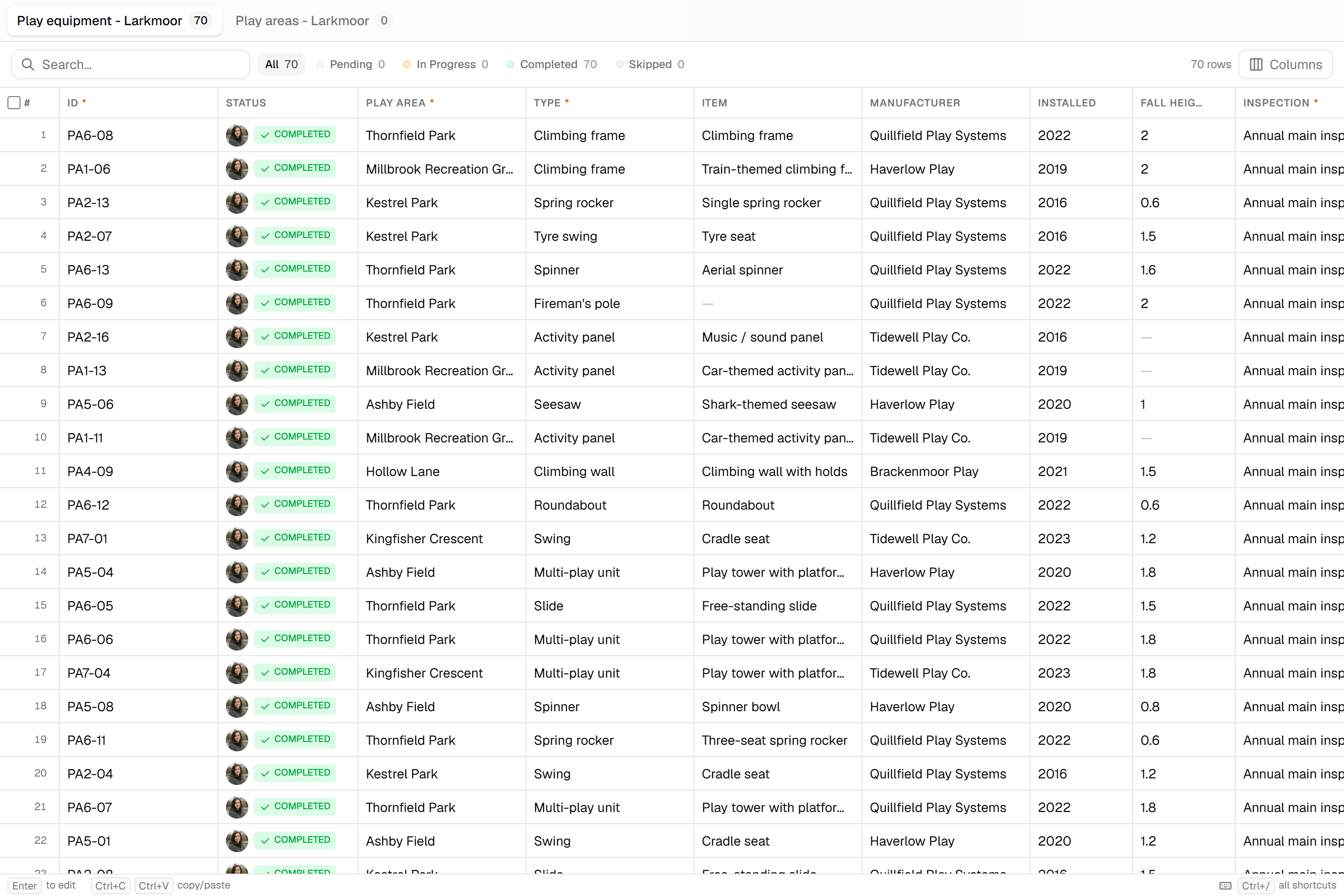
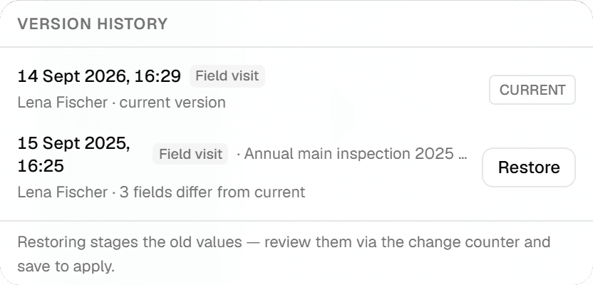
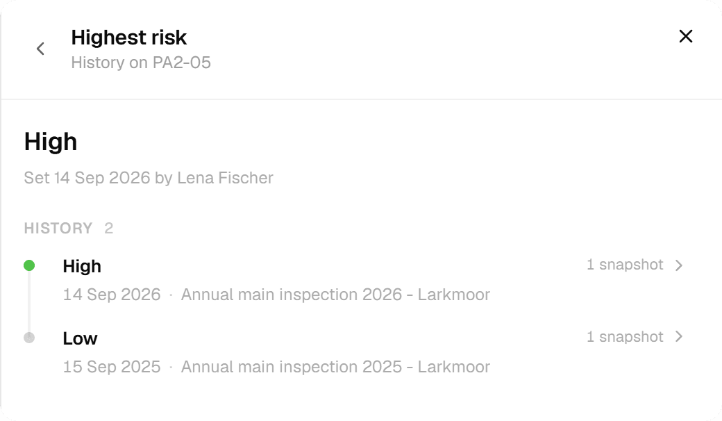
The features grid shows the version history of an item: the 2026 inspection as the current version and the 2025 inspection with the number of fields that differ. Any version can be staged for restore and reviewed before it is applied.
 06
06Hand it over
Excel with one typed column per form field for the inspection log, GeoJSON or Shapefile for the GIS, a PDF report for the insurer. Export the round's current values or a chosen version; the history stays.
The challenge
What a public-space team actually deals with
From accident insurers' guidance, audit reports and the trade press on municipal maintenance, three problems come up every time.
- 01
The burden of proof sits with the operator
When a child is hurt on a swing, the operator has to show that the equipment was checked at the required intervals by someone competent and that findings were acted on. Weekly checks on paper sheets, quarterly checks in a spreadsheet and the annual inspection in a PDF from the contractor cannot be laid end to end for one site without a day of assembling.
- 02
No complete register of sites and equipment
The accident insurers' model procedure starts with an inventory: every site, every device, manufacturer, year, impact surface. Many towns have the sites in the GIS and the devices in the head of the depot foreman. Without the register, nobody can say which checks are overdue or which devices from a certain year should be replaced before they fail.
- 03
Findings fall between depot, contractor and office
The depot notes a loose bolt, the workshop fixes it, the annual inspector never hears about it. A citizen reports broken glass in the sand, the office forwards an email, the depot cannot say whether it was the same sand pit that was cleaned yesterday. Each party keeps its own list and none of them is the site's list.
The solution
How the round runs in Geocadra
Everything below is what the product does today, shown above on real play equipment from OpenStreetMap.
The sites are a layer you import once
Load the playground, cemetery or green-space polygons from the GIS as GeoJSON, Shapefile, GeoPackage or a CAD drawing. The importer detects the projected coordinate system, places the sites on the map and keeps every attribute the file carried. The site number becomes the feature's name; nothing is renumbered.
Each round is a project on the same layer
The weekly visual check, the quarterly operational check and the annual main inspection are three projects on the same playground layer. Each has its own form, its own participants and its own progress. Because they all point at the same site, the site's history holds all three, in order, with the person who submitted each one.
Devices, findings and impact surfaces on the record
The main inspection form is filled once per device: type, manufacturer, year, function and stability, entrapment points, foundations, impact surface with measured depth against the required depth, and a findings list with a hazard class, a deadline and a cost estimate. A device that is not safe is closed on the spot and the closure is on the record with a photo.
Hand over in the format the next system wants
Excel with typed columns for the inspection log, GeoJSON or Shapefile for the GIS, a PDF report per site for the contractor or the insurer. The export takes the round's current values or a chosen version; the history stays in Geocadra either way.
How it works
Common Workflows
Six rounds as they run in the field, each backed by a form from the Geocadra marketplace. Copy the form, adapt the wording, keep the structure.
- 01
Weekly visual check of playgrounds by the depot
The depot walks its sites once a week: cleanliness, fences and signs, impact surface at a glance, anything obvious on a device. A finding gets a traffic-light hazard rating and an immediate measure, and a device that is not safe is made unusable on the spot.
- 1.Create the week's project on the playground layer with the visual check form and assign the depot's sites.
- 2.At each site, open the site on the map and fill the sheet: cleanliness, fence and gate, signage, impact surface, dangerous objects.
- 3.A finding on a device names the device, the type of defect, the hazard rating and what was done immediately.
- 4.Submit. The site's history now shows this week next to last week, and the office sees which sites were closed.
- 02
Annual main inspection by a certified inspector
Once a year every device is inspected in depth, usually by an external inspector with a certificate: foundations exposed, probe tests for entrapment, impact surface measured, stability, corrosion and rot. The inspector works in the municipality's project with their own seat.
- 1.Create the year's project on the same layer with the main inspection form and invite the inspector's firm.
- 2.The inspector fills one form per device on the site: master data, function, test points, impact surface, findings with hazard class and deadline.
- 3.A device that fails is marked not safe and closed; the closure, the barrier used and the notification are on the record.
- 4.The office exports the findings list per site to Excel and the year's report per site to PDF for the inspection log.
- 03
Headstone stability testing on cemeteries
Every standing memorial is pushed once a year by the cemetery staff; those that move are marked and the grave holders are written to. The record per grave, with the test date and the result, is the cemetery's proof of duty.
- 1.Import the grave fields as polygons or the memorials as points from the cemetery plan.
- 2.Run the year's test as a project; at each memorial record the push test result, the type of fixing and a photo of a failed one.
- 3.Memorials that fail get a warning tag on the record and a deadline for the grave holder.
- 4.Export the list of failed memorials with grave numbers for the letters; the test dates stay on each grave for next year.
- 04
Acceptance of green-space maintenance by contractors
Mowing, pruning and litter picking are contracted per maintenance class and accepted per section. The acceptance walk records what was done, what was missed and what is charged.
- 1.Import the maintenance sections with their class from the green-space register.
- 2.Run each acceptance round as a project; at each section record the performed works, defects and the photo of the state.
- 3.Sections with defects get a rework deadline; the contractor sees them in the same project.
- 4.Export the accepted sections to Excel for invoicing and keep the season's acceptances on each section.
- 05
Winter service documentation per route
Gritting and clearing have to be proven per route and per day when a claim arrives months later. Each run is a record with time, material and the sections done, on the route it belongs to.
- 1.Import the winter service routes as lines with their priority class.
- 2.For each run, open the route and record start and end time, material and quantity, and sections skipped with the reason.
- 3.A photo at a critical section closes the record for that run.
- 4.The season's runs per route are exported as one table when the insurer asks.
- 06
Gully and drain cleaning rounds
Street gullies are cleaned on a cycle and checked for damage; the cleaning history per gully decides the next interval and shows where sediment keeps coming back.
- 1.Import the gully points from the sewer register with their numbers.
- 2.Run the cleaning round as a project; record fill level before cleaning, damage to the grate or the trap, and whether a repair is needed.
- 3.Gullies that need repair are exported as a work list for the sewer contractor.
- 4.Each gully's cleaning history shows the fill levels over the years and where the interval should change.
The impact
What Changes
“The site's record answers the question the insurer asks: when was this checked, by whom, what was found and what was done. The depot's weekly sheet and the inspector's annual report are the same history. A closed device stays closed on the record until someone reopens it with a reason. The replacement list for the budget comes from the devices' years and hazard classes instead of from memory.”
Standards
Compliance & Standards
The forms follow the way each regime structures the work; the record shows the interval, the person and the finding without prescribing a national standard. Examples of what the marketplace forms map to:
- Three-level playground inspection regimes: routine visual, operational and annual main inspection (e.g. EN 1176-7)
- Visual checks at short intervals by the operator's staff, operational checks in more depth, and a main inspection once a year by a competent person; each level has its own form and its own project, all on the same sites.
- Inspector qualification and certificate on the record (e.g. DIN 79161 in Germany, RPII in the UK, CPSI in the US)
- The main inspection form carries the inspector's name, qualification and certificate number in the header, so the record shows who was competent to sign it.
- Impact-attenuating surface depth against free fall height (e.g. EN 1177 test reports, loose-fill depth tables)
- The form holds the device's free fall height, the surface material, the measured depth and the required depth, and computes the reserve; sites below the mark are one filter away.
- Annual headstone stability testing on cemeteries (e.g. the German cemetery associations' technical rules)
- A push test per memorial with the result, the fixing type and a photo; failed memorials are a list with grave numbers for the letters to the grave holders.
- Duty of care documentation for winter service and street furniture in municipal liability cases
- Runs, materials and skipped sections per route, with time stamps and the person; the season's record is exported as one table when a claim arrives.
Standards this page covers
Each standard below has its own page with the inspection regime, the rating system and the form on the marketplace.
- EN 1176 Playground InspectionThe European safety standard for playground equipment inspection covering structural integrity, entrapment testing, and impact-absorbing surfacing with three inspection tiers: routine visual, operational, and annual.
- ASTM F1487 Playground SafetyThe U.S. standard for public playground equipment safety, defining use zone clearances, entrapment openings, protrusion limits, protective surfacing requirements, and a four-level NRPA hazard priority rating.
- CPSC 325 Playground SafetyThe primary U.S. federal guideline for playground hazard identification, covering protective surfacing, the Dirty Dozen hazard categories, and a five-level Hazard Priority Rating (1–5).
- CSA Z614 Playground SafetyThe Canadian national standard for children's playground equipment and surfacing safety, with a 1-to-5 equipment condition scale and A/B/C hazard priority classification.
- AS 4685 Playground InspectionThe Australian standard for operational inspection of playground equipment, surfacing compliance, and site safety with a 1–5 condition rating.
- EN 15312 MUGA InspectionThe European standard for multi-use games area (MUGA) safety, covering inspection types, surfacing, fencing, entrapment testing, and a likelihood-by-severity risk assessment matrix.
- EN 16630 Outdoor Fitness InspectionThe European safety standard for permanently installed outdoor fitness equipment, defining a three-tier inspection regime with routine, operational, and annual assessments plus a 1–5 condition scale.
- BIV-Richtlinie Gravestone SafetyThe German guild directive for gravestone stability inspection using a two-stage process — visual assessment and 300 N force test — producing a four-grade stability rating (I–IV) under Verkehrssicherungspflicht.
- CCUS Cemetery PreservationThe US Cemetery Conservators United Standards for preservation assessment of monuments and headstones, using a six-criterion 1-to-10 method evaluation and six conservation categories.
- ICCM Memorial Safety InspectionThe ICCM Management of Memorials standard is the UK operational framework for assessing memorial stability in burial grounds. It uses a two-stage process of visual triage and 25 kg hand test to classify memorials into Priority 1 (Red), Priority 2 (Amber), or Priority 3 (Green).
- UK MoJ Memorial Safety InspectionThe UK Ministry of Justice guidance for burial ground memorial stability testing using a two-stage process — visual survey and 25 kg hand test — with a three-tier risk classification (Category 1–3).
- NEN 2767 Street Furniture ConditionThe Dutch standard for objective condition assessment of street furniture — benches, bollards, bins, shelters, signage — using the NEN 2767 defect matrix with a 1-to-6 rating scale.
- CROW KOR Visual Quality AssessmentThe Dutch CROW standard for visual quality assessment of public spaces using reference images (Beeldmeetlat) and an A+ to D quality scale across categories including litter, weeds, surface damage, and vegetation.
- IPWEA Practice Note 10.1 Park AssetsThe Australasian practice note for condition assessment of park and recreation assets using the IIMM 1-to-5 condition grading scale, defect and failure mode classification, and remaining useful life estimation.
- SF Park Maintenance StandardsThe San Francisco Proposition C park maintenance standards using binary Met/Not Met compliance across 14 park features and a 91% citywide target score.
- DIN 79008 Bike Parking InspectionThe German standard for bicycle parking facility safety and quality, covering system classification, spacing geometry, safety checks, and three-level DIN compliance assessment.
- DIN 32984 Tactile Paving InspectionThe German standard for tactile ground surface indicators for visually impaired persons, covering profile geometry verification, luminance contrast measurement, and a 1-to-5 condition grade scale.
- ISO 23599 Tactile Paving InspectionThe international standard for tactile walking surface indicators (TWSI), covering dimensional compliance, luminance contrast verification, and a 1-to-5 condition rating scale.
Questions
Frequently Asked Questions
- Does Geocadra schedule the weekly checks?
- No. A recurring round is a manual pattern: you create next week's project on the same layer, choose the same form and assign the sites. Nothing runs by itself, which is what an operator wants for a record that has to hold up in court.
- Does this replace the paper inspection log?
- It replaces the assembling. Each check is on the site with the person, the time and the values; the Excel export per site and per year is the log the insurer asks for. Whether your legal department also wants the PDF per site printed and filed is your call; both come from the same record.
- Can the external playground inspector work in our project?
- Yes. The inspection firm is invited to the project with its own seat and submits from the site. The municipality sees the findings the day they are recorded, not when the annual report arrives.
- We have the sites in the GIS but no device register. Where do the devices go?
- The main inspection form is filled once per device on the site, so the first full round builds the device list: number, type, manufacturer, year and impact surface per device. From then on every inspection of the device is on the site's record.
- Where do citizen reports fit?
- A report is recorded on the site it concerns, with the visual check form or a short report form from the marketplace, and shows up in the same history as the depot's checks. The depot sees whether the sand pit in the report was cleaned yesterday.
- We are a small depot without a GIS. Does this still work?
- Yes. Import the sites once from any file you have, including a spreadsheet with coordinates or a drawing, and work on the map from a phone. The export gives you the GIS files if you ever get a GIS.
See your own fieldwork in Geocadra
Set up a project, run an inspection and export the result. Free for 14 days, no credit card.
No credit card requiredFree trial included